
Public Exhibition - Draft Bush Fire Prone Land Map
Consultation has concluded
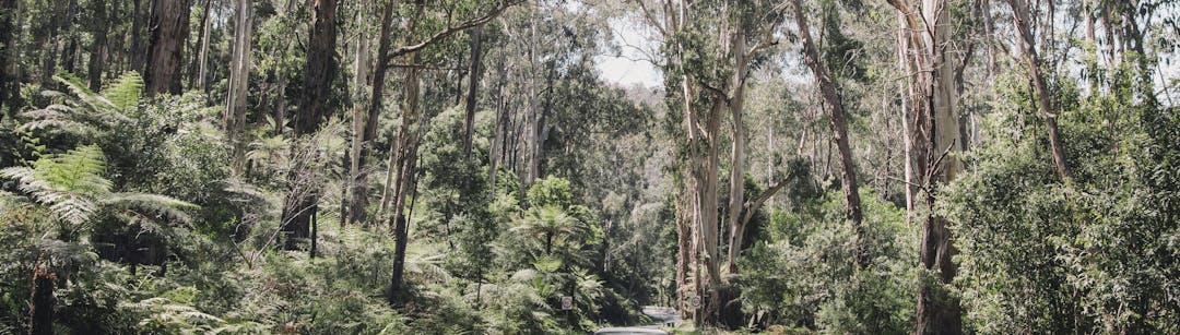
In collaboration with the NSW Rural Fire Service (RFS), Council is updating the mapping of bush fire prone land across the Lismore Local Government Area (LGA).
The draft Bush Fire Prone Lands Map 2025 is being publicly exhibited to notify residents and landowners of the proposed changes and invite feedback. The draft 2025 mapping will replace Council's 2009 mapped areas. It reflects the most recent guidance on how bush fire prone areas are mapped - shaped by the introduction of a new vegetation category. Once certified, the mapping will be used to ensure new developments have adequate bush fire protection.
UPDATE - SEPTEMBER 2025
What we heard:
During the public consultation period (12 May – 2 June 2025), Council received four submissions. Key themes raised included:
- Additional requirements resulting from changes to vegetation category classifications, and
- Potential impacts on insurance premiums.
These submissions were provided to the NSW RFS for consideration prior to finalising the Lismore Bush Fire Prone Lands Map 2025.
What's next?
The NSW RFS are in the final stages of certifying the Lismore Bush Fire Prone Lands Map 2025. Once certified, the updated maps will be accessible via Council’s online Intramaps viewer. Updates to this page will also be provided to reflect the latest information.
Note: the draft Bush Fire Prone Lands Map 2025 can be accessed here
The draft Bush Fire Prone Land Map 2025 for the Lismore LGA has been produced in conjunction with the RFS using their updated mapping guide ‘Bush Fire Prone Land Mapping Guidelines (September 2024)'. Council has worked with the RFS to review and increase the mapping's accuracy and are seeking your help for any final improvements.
Following the integration of any required changes from this community review, the draft Bush Fire Prone Land Map 2025 will be sent to the NSW RFS Commissioner for certification. Once certified, the new map will become effective immediately and replace the current 2009 Bush Fire Prone Land Map.
The major changes to the Draft Bush Fire Prone Land Map for the Lismore region are based on the introduction of a third vegetation category – Class 3 – reflecting the medium bush fire risk presented by grasslands and pastures. This category includes vegetation such as cropping and cattle grazing pastures, sugar cane, freshwater wetlands, scrub, weed, and exotic vegetation. (Refer to Table 1 – Bush fire prone land vegetation categories below for further details).
The introduction of this new vegetation category means that most areas within the Lismore LGA will be considered bush fire prone, with only the more urbanised areas excluded from the mapped risk areas.

All councils are required to map bush fire prone land within their LGA under section 10.3 of the Environmental Planning and Assessment Act 1979 (the Act). Once certified, the Bush Fire Prone Lands Map 2025 will be used to determine whether all new development plans in bush fire prone areas have included adequate bush fire protection measures. While existing buildings do not require retrospective modifications simply because of the mapping changes, all residents living in a bushfire-prone area should understand the increased risk to their property and have a Bush Fire Survival Plan.
Vegetation categories and exclusions
Vegetation is identified and determined in accordance with the appropriate vegetation types for all land within the LGA including both private and public land. Vegetation is then classified into the Australian Standard (AS) 3959:2018 Construction of buildings in bushfire-prone areas categories based on vegetation formation and potential hazards.
Table 1 - Bush fire prone land vegetation categories
Category | Description | Vegetation formation |
Vegetation Class 1 | This vegetation category has the highest combustibility and likelihood of forming fully developed fires including heavy ember attack and spot fires.
Includes 100 metre (m) buffer. | Dry Sclerophyll Forests
|
Wet Sclerophyll Forests
| ||
Grassy Woodlands
| ||
Forested Wetlands
| ||
Heathlands | ||
Vegetation Class 2 | This vegetation category has lower combustibility and/or limited potential fire size due to the vegetation area shape, size, topography, and management practices. This includes lower risk vegetation like remnant vegetation (see definition in Glossary) or other parcels of land that present a bush fire hazard and are neither Category 1 or 3 and are not excluded (see Section 7.3)
Include 30 m buffer. | Rainforest (lower risk remnants could comprise any formations) |
Vegetation Class 3 | This vegetation category is considered medium bush fire risk vegetation. Details of inclusions and exclusions of grasslands are provided in the Glossary.
Include 30 m buffer. | Grassland |
Freshwater Wetlands | ||
Arid Shrublands (Acacia and Chenopod) | ||
Semi-Arid Woodlands (shrubby and grassy sub-formations) | ||
Alpine Complex |
*Not all vegetation types included in the categories are reflected by the Vegetation Classifications.
There are several exclusions that apply to the bush fire prone land mapping which include:
-Single areas of vegetation less than 1 hectare in area and greater than 100 metres separation from other areas of Category 1, 2 or 3 vegetation.
-Multiple areas of vegetation less than 0.25 hectares in area and not within 20 metres of each other.
-Strips of vegetation less than 20 metres in width, regardless of length and not within 20 metres of other areas of Category 1, 2 or 3 vegetation.
-Areas of “managed grassland” including grassland on, but not limited to, recreational areas, commercial/industrial land, residential land, airports/airstrips, maintained public reserves and parklands, commercial nurseries.
-Areas of managed gardens and lawns within curtilage of buildings.
-Non-vegetated areas, including waterways, exposed beaches, roads, footpaths, buildings and rocky outcrops.
-Managed botanical gardens.
-Land used for orchards, vineyards, market gardens, nurseries.
-Saline wetlands including mangroves unless dominated by sedges or other flammable vegetation.
-Other areas that, due to their size, shape and overall risk are not considered Category 1, 2 or 3 vegetation.
Council is seeking feedback from the community on the draft Bush Fire Prone Land Map 2025 for the Lismore region, which will be considered before submission for certification by the NSW RFS Commissioner.

You are invited to review the draft documents and provide your feedback via submission until 4pm, Monday 2 June 2025.
You can provide your feedback via a submission in the following ways:
- Online: see the submission form below
- Email: council@lismore.nsw.gov.au
- In writing to the General Manager, Lismore City Council, PO Box 23A, Lismore, NSW 2480

Click the link above to obtain direct access to Council's online map viewer. Detailed instructions on how to determine if your property is in a bush fire prone area can be found within the FAQ's.
